|
hidden
|
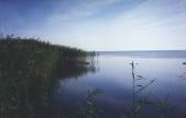
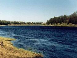
Chudskoye Lake
LAKE CHUDSKOYE (obsolete: Peipus, Est. Peipsi jarv.) It is located in Estonia and Russian Federation (Pskov Oblast; in Leningrad Oblast, a small portion in Slantsi District.) The lake constitutes a common body of water with Lake Pskovskoye, to... more
|
|
|
|
hidden
|
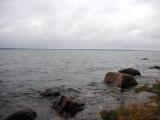
Gulf of Finland, the
GULF OF FINLAND, in the eastern part of the Baltic Sea. Area: about 29,800 sq. km (7% of the Baltic Sea area.) Length: 400 km (from the Khanko Peninsula to SPb.) Max. width: 130 km (near the western border of Leningrad Oblast, at the meridian of... more
|
|
|
|
hidden
|
Izhora River, the
IZHORA, river, left - hand tributary of the Neva River. Total length: 76 km. Basin area: abt. 1,000 sq. km. The river springs from Skvoritsy Village, Gatchina District. It flows across Gatchina and Tosno Districts of the Leningrad Oblast and Kolpino... more
|
|
|
|
hidden
|
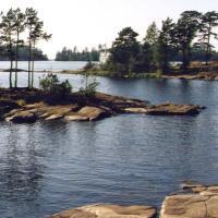
Ladoga Lake
LAKE LADOGA. Located in Leningrad Oblast and the Republic of Karelia. In the Middle Ages, it was called Nevo (Baltic Finnish nevo = “moss marsh.”) The current name originates from the middle Scand. Aldoga (fm the Baltic Finnish Alodejogi = “the... more
|
|
|
|
hidden
|
Ladoga Canals, the
LADOGA CANALS. They connect the mouth of the Volkhov River and the head of the Neva, extending along the south coast of Lake Ladoga. There are two canals, Staroladozhsky and Novoladozhsky. The canal construction was urged by the necessity to have a... more
|
|
|
|
hidden
|
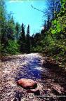
Lava River, the
LAVA, a river in Kirovsk District. Length: 51 km. It flows out of the marshes that are situated to the east of the urban settlement of Nazia, and it flows into Lake Ladoga (Petrokrepost Bay.) The toponym is of a Baltic Finnish origin (Finnish.... more
|
|
|
|
hidden
|
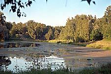
Luga River, the
LUGA, river. It flows in Novgorod Oblast and in Luga, Volosovo, and Kingisepp Districts of Leningrad Oblast. Length: 353 km (the longest river in Leningrad Oblast.) Catchment area: 13,200 sq. km. Flow rate: 100 cu. m / s. Its width is 50-100 m in... more
|
|
|
|
hidden
|
Mga River, the
MGA, a river, left-hand tributary of the Neva. Length: 55 km. Average flow rate in the mouth: 5.3 cu. m / s, catchment area: 709 sq. km. It flows out of Lake Maluksinskoye in the central part of Leningrad Oblast and it flows into the Neva within... more
|
|
|
|
hidden
|
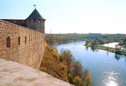
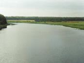
Narova River, the
NAROVA (Narva, obsolete Estonian Alukse), river. Length: 77 km. Catchment area: 56,200 sq. km. Flow rate: 399 cu. m/s. It flows out of Lake Chudskoye and it flows into the Narva Bay of the Baltic Sea. N. is a borderline between Russian Federation... more
|
|
|
|
hidden
|
Neva River, the
NEVA, river in Leningrad Oblast and SPb. It was formed c. 3000 years ago due to a water breakthrough from Lake Ladoga to the Baltic Sea along the old valleys of the Mga and Tosna rivers. The toponym “Neva” is borrowed from the Baltic Finnish... more
|
|
|
|
hidden
|
Okhta River, the
OKHTA (Finnish “bear river”), a river in the Karelian Isthmus, largest right-hand tributary of the Neva. Length: 90 km, width: – 30-40 m, predominating depth: 0.5-1 m, max. depth: 5.5 m. Basin area: 768 sq. km. Average flow rate at the mouth: 7.2... more
|
|
|
|
hidden
|
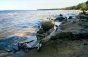
Onega Lake
LAKE ONEGA (Onezhskoye Ozero), located in the north of Russia’s European part within the Republic of Karelia, Vologda Oblast (southern and south-eastern part) and Leningrad Oblast (south-western part.) The L. O. boast belongs to the north-eastern... more
|
|
|
|
hidden
|
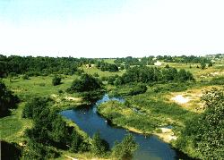
Oredezh River, the
OREDEZH, river, right-hand tributary of the Luga River. Length: 192 km. Catchment area: 3,200 sq. km. Flow rate: 20 cu. m/s. It originates from the springs on the southern slope of the Izhora Hills, in the Dontso tract. It flows across Volosovo,... more
|
|
|
|
hidden
|
Oyat River, the
OYAT, river, left-hand tributary of the Svir River. Length: 266 km. The average flow rate in the mouth is 54.8 cu. m/s, catchment area: 5220 sq. km. Its source is Lake Chaimozero on the Veps Hills (in Vologda Oblast, 7 km away from the Leningrad... more
|
|
|
|
hidden
|
Pasha River, the
PASHA, river, left-hand tributary of the Svir River. Length: 242 km. The average flow rate in the mouth is 69.2 cu. m/s, catchment area: 6650 sq. km. It flows out of Lake Pashozero in the east of Leningrad Oblast, and crosses Tikhvin and Volkhov... more
|
|
|
|
hidden
|
Plyussa River, the
PLYUSSA, river. Flows in Pskov Oblast and in Slantsi District of Leningrad Oblast. Length: 281 (according to other data, 295) km. Catchment area: 6,500 sq. km. Flow rate: 50 cu. m/s. It flows out of Lake Zaplyusye (Zaimosskoye) and into the Narva... more
|
|
|
|
hidden
|
Ragusha River, the
RAGUSHA, river, left-hand tributary of the Volozhba River (Lake Ladoga basin.) Length: 42 km. The width varies from 3-5 m at the source to 10-15 m near the mouth. It flows out of the south-eastern part of Lake Nikulinskoye in Khvoinaya District,... more
|
|
|
|
hidden
|
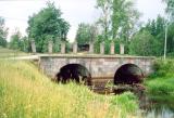
Ropshinsky Canal, the
ROPSHA CANAL (Old Peterhof Canal), a part of the Peterhof fountain water passage that is the gravity hydraulic system. It originates on the Ropsha Hills, from the Shingarka (River) (or Shinkarka, or Fabrichnaya River.) Length: 24 km, width: 6.4 m,... more
|
|
|
|
hidden
|
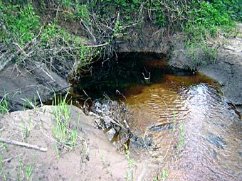
Sablinka River, the
SABLINKA, a river in Tosno District, left-hand tributary of the Tosna River. Length: 26 km. Catchment area: 84.54 sq. km. It originates near Yeglizi village. Among the localities on the river’s banks, Ulyanovka urban settlement is the largest. S.... more
|
|
|
|
hidden
|
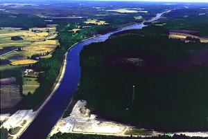
Saymensky Canal, the
SAIMAA CANAL. Built in 1843-56 to connect Lake Saimaa to the Gulf of Finland. It is situated in Vyborg District of Leningrad Oblast and in Finland. Attempts to build the canal were made in 1499–1511 and in 1607-09. In 1835, a survey was carried... more
|
|
|
|
hidden
|
Sestra River, the
SESTRA (Swedish Systerback, Finnish Rajajoki / “Frontier River”), a river in Vsevolozhsk and Vyborg Districts of Leningrad Oblast and in St. Petersburg. Length: 74 km. Depth: up to 3 m (in the mouth.) Catchment area: 393 sq. km. It begins in a marsh... more
|
|
|
|
hidden
|
Slavyanka River, the
SLAVYANKA, a river in Gatchina District of Leningrad Oblast and in St. Petersburg, left-hand tributary of the Neva. Length: 39 km. Catchment area: 249 sq. km. Flow rate: 1.8 cu. m/s. It originates from the Taytsi Springs on the Pyazelevsky Hills... more
|
|
|
|
hidden
|
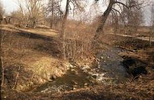
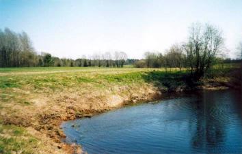
Suyda River, the
SUYDA (Suydinka), a river in Gatchina District. Length: 63 km. Catchment area: 475 sq. km. Flow rate: 3.1 cu. m/s. Its source is in a marsh north-west of Tikhkovitsi village. It is a karst river. It flows among fields and meadows, with its banks... more
|
|
|
|
hidden
|
Svir River, the
SVIR, a river in the north-east of Leningrad Oblast. Length: 224 km. Average flow rate at the mouth: 780 cu. m/s, catchment area: 84,400 sq. km. It flows from Lake Onega at its south-western end, crosses Podporozhye and Lodeynoye Pole Districts, and... more
|
|
|
|
hidden
|
Syas Canals , the
SYAS CANALS. They connect the mouths of the Volkhov and Syas Rivers, and extend along the south-eastern coast of Lake Ladoga, being an extension of the Ladoga Canals. Currently they are in Volkhov District, from Nemyatovo village to Syasstroy town.... more
|
|
|
hidden
|
Syas River, the
SYAS, a river in the south-eastern Priladozhye. Length: 260 km, of which, abt. 190 km within Leningrad Oblast. The average flow rate is 61.6 cu. m/s, and the catchment area, 7330 sq. km. It originates in the north-east of Novgorod Oblast, 6 km... more
|
|
|
|
hidden
|
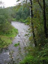
Tigoda River, the
TIGODA, river, left-hand tributary of the Volkhov. Length: 143 km, average flow rate: 4.21 cu. m/s, catchment area: 589 sq. km. It originates among the bogs in the extreme south of Tosno District north-east of Ogorelye railway station. In its upper... more
|
|
|
|
hidden
|
Tikhvin Canal System
TIKHVIN CANAL SYSTEM, a traffic artery in the north-west of European Russia. It connected the basins of the Baltic Sea and the Volga in the 19th-20th cc. It began at the city of Rybinsk on the Volga (later at the Rybinsk Reservoir), extended via the... more
|
|
|
|
hidden
|
Tikhvinka River, the
TIKHVINKA, river, right-hand tributary of the Syas River. Length: 155 km. Average flow rate: 19.9 cu. m3/s. It originates from Lake Krupino in Boksitogorsk District, 5 km north of Yefimovsky urban settlement, and flows in the latitudinal direction... more
|
|
|
|
hidden
|
Tosna River, the
TOSNA, river, left-hand tributary of the Neva. It flows in Luga, Tosno, and Kirovsk Districts of Leningrad Oblast and in St. Petersburg. Length: 121 km. Catchment area: 1640 sq. km. Flow rate: 11.6 cu. m/s. The source is in Luga District, 5 km... more
|
|
|