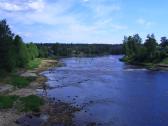
Narva River, the
Group name
Topographical landmarks
Mentioned in articles:
|
hidden
|
Archaeological monuments
Archaeological monuments of the Leningrad Oblast are settlements, grads, burial grounds, religious objects and other material trails of the past. Settling the oblast territory took place during the Mesolithic period. The age of the most ancient... more
|
|
|
|
hidden
|
Ayramoiset, an ethnic group of Ingermanlandia Finns
The Ayramoiset (Ayramoiset, Evremeisy, Evrimeisy) is an ethnic group of the Finns of Ingermanlandia. Descendants of the migrants of the 17th century to Ingermanlandia from the region of Euryapyae on the Karelian Isthmus. The Ayramoiset kept archaic... more
|
|
|
hidden
|
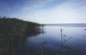
Chudskoye Lake
LAKE CHUDSKOYE (obsolete: Peipus, Est. Peipsi jarv.) It is located in Estonia and Russian Federation (Pskov Oblast; in Leningrad Oblast, a small portion in Slantsi District.) The lake constitutes a common body of water with Lake Pskovskoye, to... more
|
|
|
|
hidden
|
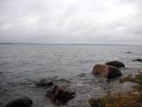
Gulf of Finland, the
GULF OF FINLAND, in the eastern part of the Baltic Sea. Area: about 29,800 sq. km (7% of the Baltic Sea area.) Length: 400 km (from the Khanko Peninsula to SPb.) Max. width: 130 km (near the western border of Leningrad Oblast, at the meridian of... more
|
|
|
|
hidden
|
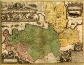
Ingermanlandia
INGERMANLANDIA (Swed. Ingermanland, Rus. Izhora Land or Ingria), historic and cultural region in the western part of the Leningrad Oblast (Kingisepp, Volosovo, Lomonosov, Vsevolozhsk, Gatchina, Tosno, western part of Kirovsk Districts.) The western... more
|
|
|
|
hidden
|
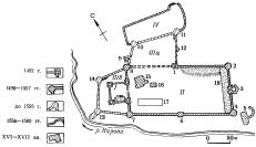
Ivangorod Fortress
Ivangorod Fortress (The Ivangorod Town is located on the right bank of river Narova) This fortress was founded in 1492 on the Devichiya Hill(Maiden Hill) and it is located opposite the castle order Narva. The fortress was named in honour of grand... more
|
|
|
|
hidden
|
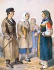
Izhora (Izhora men)
Izhora (Izhoras, the own native name is Izurit) is an ethnic community. Their language is related to the Baltic-Finnic subgroup of the Finno-Ugric branch of the Uralic language family. Accorging to the most widespread version the Izhora separated... more
|
|
|
|
hidden
|
Luga River, the
LUGA, river. It flows in Novgorod Oblast and in Luga, Volosovo, and Kingisepp Districts of Leningrad Oblast. Length: 353 km (the longest river in Leningrad Oblast.) Catchment area: 13,200 sq. km. Flow rate: 100 cu. m / s. Its width is 50-100 m in... more
|
|
|
|
hidden
|
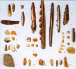
Mesolithic monuments, The.
The Mesolithic monuments. Mesolithic (the Middle Stone Age) is the transitional epoch between the Palaeolithic period and the Neolithic period (in Europe - from c 10000 to 7000 BC). Microlite silicon tools, various goods made of bone and horn are... more
|
|
|
|
hidden
|
Slantsi District
SLANTSY DISTRICT, a part of Leningrad Oblast. Population: 2,200 sq. km. Population: 47,900. S. D. comprises Slantsy Town (adm. center) and 155 rural localities. It borders Kingisepp, Volosovo, and Luga Districts of Leningrad Oblast, Gdov District... more
|
|
|
|
hidden
|
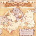
Toponymia of the Leningrad Oblast, the
The leningrad Oblast toponymia. Toponymia is the combination of toponyms, proper names of geographical objects. There are several kinds of toponyms: hydronym, a name of water object; oikonym, a name of a settlement; horonym, an element of relief;... more
|
|
|
hidden
|
|
hidden
|
|
hidden
|
|
hidden
|
|
hidden
|
|
hidden
|
|
hidden
|
|