ru
Articles / Syas Canals , the

Syas Canals , the


Subject / Topography/Reservoirs and waterways

SYAS CANALS. They connect the mouths of the Volkhov and Syas Rivers, and extend along the south-eastern coast of Lake Ladoga, being an extension of the Ladoga Canals. Currently they are in Volkhov District, from Nemyatovo village to Syasstroy town. The construction of a canal that would connect the Volkhov and the Syas to bypass Lake Ladoga was initiated by Peter I in the early 18th century, during the construction of the Ladoga Canals. The initial work was carried out in 1724 but only in 1764 the Senate presented to Catherine II a report proposing to start the construction of a canal from Ladoga town to Syasskiye Ryadki . The canal width was intended to be 27.7 m, its depth, 2.1 m, and its length, abt. 11 km. No locks or dams were designed. The work carried out in 1765-66, then in 1774-83. The Syas Canal was put into operation on June 1, 1802. In 1802-10, another canal was built between the mouths of the Svir and Syas Rivers, which was named Svir Canal. In 1878, the construction of new canals parallel to the existing ones was started closer to the Lake Ladoga shore. The construction of the New Syas (Empress Maria Fyodorovna) Canal was completed in 1880, and of the construction of the New Svir (Emperor Alexander III) Canal was completed in 1883. In the construction of the Syas Canal, traces of prehistoric settlements with stone and bone implements, and a wooden dugout boat were discovered near Syasskiye Ryadki village.

Authors
Yegorov, Sergey Borisovich

Persons
Catherine II, Empress
Peter I, Emperor

Geography
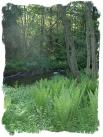
Topographical landmarks/Ladoga Canals, the
Topographical landmarks/Ladoga Lake
Historical Toponyms/Ladoga Town
Topographical landmarks/Svir Canal, the
Topographical landmarks/Svir River, the
Topographical landmarks/Syas River, the
Historical Toponyms/Syas'skiye Ryadki, settlement
Topographical landmarks/Volkhov River, the

Bibliography
Горелов В. Речные каналы в России. Л.-М., 1953
Евгеньев Г. По водным путям Северо-Запада. Л., 1958
СИНЯВИНО. ЛЕНИНГРАДСКОЙ ОБЛ. ДЕРЕВНЯ ВАГРИСЕЛКА ШЛИССЕЛЬБУРГСКОГО УЕЗДА. URL: http://maklov.narod.ru/simple.html


Mentioned in articles:

Drainage network
HYDROGRAPHIC NETWORK. Over 19500 rivers and 1800 lakes (Ladoga and Onega being the largest ones) form the H. N. of the Leningrad Oblast. The river network is dense and ramified. One exception is the Izhora Hills where the river network density is... more


Mesolithic monuments, The.
The Mesolithic monuments. Mesolithic (the Middle Stone Age) is the transitional epoch between the Palaeolithic period and the Neolithic period (in Europe - from c 10000 to 7000 BC). Microlite silicon tools, various goods made of bone and horn are... more