|
hidden
|
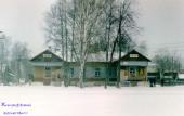
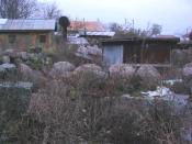
Alyokhovshchina, village
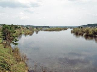
ALYOKHOVSCHINA, a village in Lodeynoye Pole District. Population: 1882. It is situated on the banks of the Oyat River. It is situated at the crossing of motor roads to Lodeynoye Pole, Tikhvin, Domozhirovo, and Yaroslavichi. The name originates from... more
|
|
|
|
hidden
|
Antrea, town*, v. Kamennogorsk
reference
|
|
|
hidden
|
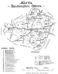
Areas
AREAS (Okrug), adm./territorial units introduced in the USSR by the first Soviet adm./territorial division reform (1923-29). The reform was developed by the Gosplan (State organization for the economic planning) and consisted in cancellation of the... more
|
|
|
|
hidden
|
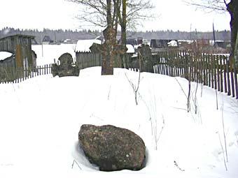
Astracha, village
ASTRACHA, a village in Boksitogorsk District. Population: 48. It situated on the left bank of the Tikhvinka River, at the Novaya Ladoga-Yaroslavl Highway, 3 km north-west of the railway station of the same name. The name originates from the... more
|
|
|
|
hidden
|
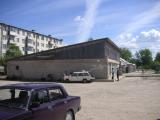
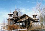
Baryshevo, settlement
BARYSHEVO, a settlement in Vyborg District. Population: 299. It situated on the bank of the Vuoksa River. It was established in 1949 in a merger of the localities Paakkola, Ojapelto, Seppälä, and Pölläkkälä. Pölläkkälä (the name originates from the... more
|
|
|
|
hidden
|
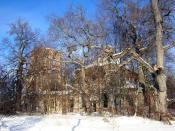
Beseda, settlement
BESEDA, a settlement in Volosovo District. Population: 1000. Initially, it was an estate built by M. S. Lalayev in the early 19th c. The estate was purchased by A. F. Weimarn in 1829. P.A. Weinmarn, his son, was a resident in B. and he bequeathed ... more
|
|
|
|
hidden
|
Boksitogorsk District
BOKSITOGORSK DISTRICT, a part of Leningrad Oblast. Population: 34,800. Area: 7163 sq. km. Adm. center: Boksitogorsk Town. The district comprises Yefimovsky urban settlement and 275 inhabited localities. It borders Tikhvin District of Leningrad... more
|
|
|
|
hidden
|
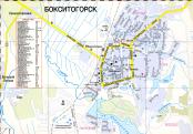
Boksitogorsk, town
BOKSITOGORSK, town, adm. center of Boksitogorsk District. Population: 17,400. It is situated on the Pyardomlya River, a right-hand tributary of the Volozhba. It was founded in 1929 at the place of development of bauxite deposits, and was named... more
|
|
|
|
hidden
|
Bolshaya Izhora, urban settlement
BOLSHAYA IZHORA, an urban settlement in Lomonosov District. Population: 3,800. Located on the southern coast of the Gulf of Finland, near the Bolshaya Izhora railway station of the Oranienbaum-Kalische branch. The Chornaya Rechka river (Izhorka in... more
|
|
|
|
hidden
|
Bolshaya Vruda, village
BOLSHAYA VRUDA, a village in Volosovo District. Population: 2,100. It situated in the upper reaches of the Vruda River (right-hand tributary of the Luga), on the Volosovo-Opolye Highway south-west of Vruda railway station of the Gatchina-Ivangorod... more
|
|
|
|
hidden
|
Bolshoy Sabsk, village
BOLSHOY SABSK, a village in Volosovo District. Population: 1300. It situated at the point of the Saba River flowing into the Luga on the Moloskovitsi-Osmino Highway. The toponym Saba is of Baltic Finnish origin, from Estonian saba = “tail” or... more
|
|
|
|
hidden
|
Bolshoye Kuzyomkino, village
BOLSHOYE KUZYOMKINO (Finnish Narvusi), a village in Kingisepp District. Population: 961. It situated at the confluence of the Mertvitsa and the Luga. It was first mentioned in Swedish sources in 1614 (in July 2004, the 390th anniversary of its... more
|
|
|
|
hidden
|
Bolshoye Zarechye, village (Volosovo District)
BOLSHOYE ZARECHYE, before 1943 a village in Volosovo District. It was located on the right bank of the Oredezh River on the Vyra-Kikerino Highway. It was mentioned in the 1499/1500 scribe roll as the center of a Novgorod pogost. Population: Russians... more
|
|
|
|
hidden
|
Budogoshch, urban settlement
BUDOGOSHCH, an urban settlement in Kirishi District. Population: 3,900. It is situated on the Pchevzha river (right-hand tributary of the Volkhov.) It is situated at the crossing of the railway lines to Mga, Tikhvin, and Nebolchi, and... more
|
|
|
|
hidden
|
Cherepovets Gubernia, the
CHEREPOVETS GUBERNIA, adm. and territorial unit with the center in the city of Cherepovets in the North-West of Russia in the early 20th century. The resolution to establish C. G. was adopted in 1918 at the meeting of representatives of five... more
|
|
|
hidden
|
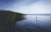
Chudskoye Lake
LAKE CHUDSKOYE (obsolete: Peipus, Est. Peipsi jarv.) It is located in Estonia and Russian Federation (Pskov Oblast; in Leningrad Oblast, a small portion in Slantsi District.) The lake constitutes a common body of water with Lake Pskovskoye, to... more
|
|
|
|
hidden
|
Co-operative gardens
CO-OPERATIVE GARDENS, noncommercial organizations established in the form of noncommercial partnerships or consumers’ cooperatives (their activity is regulated by the federal laws “On Noncommercial Organizations” of Jan. 12, 1996 and “On Gardening,... more
|
|
|
|
hidden
|
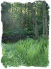
Drainage network
HYDROGRAPHIC NETWORK. Over 19500 rivers and 1800 lakes (Ladoga and Onega being the largest ones) form the H. N. of the Leningrad Oblast. The river network is dense and ramified. One exception is the Izhora Hills where the river network density is... more
|
|
|
|
hidden
|
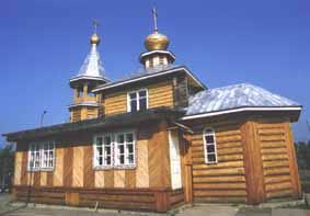
Druzhnaya Gorka, urban settlement
DRUZHNAYA GORKA, an urban settlement in Gatchina District. Population: 3,700. The settlement appeared in the early 19th century close to the Druzhnaya Gorka glass factory founded by German businessmen Rittings in 1801. The factory became especially... more
|
|
|
|
hidden
|
Dubno, village
DUBNO, a village in Volkhov District. Population: 38. It is located 18 km away from Novaya Ladoga town, to which D. is subordinated administratively. It is located on the Staroladozhsky and Novoladozhsky Canals at the southern coast of Lake Ladoga.... more
|
|
|
|
hidden
|
Dubrovka, urban settlement
DUBROVKA, an urban settlement in Vsevolozhsk District. Population: 5,400. It is situated on the right bank of the Neva near Nevskaya Dubrovka railway station. The settlement was founded at a sawmill and paper mill in 1911. Currently, the core... more
|
|
|
|
hidden
|
Dyatlitsi, village
DYATLITSI, a village in Lomonosov District. Population: 133. It is located in the northern part of the Izhora Hills, east of the Voiskovitsi-Bolshaya Izhora highway. First mention was in Novgorod’s scribe roll of 1499/1500 as the center of... more
|
|
|
|
hidden
|
Enso*, v. Svetogorsk, town
reference
|
|
|
hidden
|
Farmsteads
FARMSTEADS, settlements (mostly of one homestead), separated into a farm on a plot of land individually owned or used. In the Russian tradition, the term F. as applied to homesteads in Finnish villages of a scattered planning (in particular,... more
|
|
|
|
hidden
|
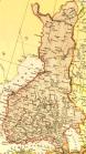
Finland
FINLAND, country in Northern Europe. Borders Sweden, Norway, the RF (Murmansk Oblast, Republic of Karelia, Leningrad Oblast.) Located on the coasts of the Gulf of Bothnia and Gulf of Finland, Baltic Sea. Area: 338,000 sq. km (abt. 10% being inland... more
|
|
|
|
hidden
|
Fornosovo, urban settlement
FORNOSOVO, an urban settlement in Tosno District. Population: 4,900. It is situated at Novolisino Station at the crossing of the Gatchina-Tosno and Pavlovsk-Novgorod railway lines. It appeared in 1949 as a workers’ settlement for development of... more
|
|
|
|
hidden
|
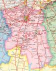
Gatchina District
GATCHINA DISTRICT, municipal entity. Population: 111,600. Area: 2850.3 sq. km. Established in 1927. Due to renaming of Gatchina Town, it was called Trotsk District in 1927-29, and Krasnogvardeisk District in 1929-44.Gatchina district borders with... more
|
|
|
|
hidden
|
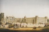
Gatchina, town
GATCHINA (Trotsk in 1923-27, Krasnogvardeisk in 1927-44), a town in Leningrad Oblast, adm. center of Gatchina District. Population: 82,900 (the largest town in the Leningrad Oblast.) First mentioned in the Novgorod scribe roll of 1499 -1500 as... more
|
|
|
|
hidden
|
Gatchino, town*, v. Gatchina, town
reference
|
|
|
hidden
|
Gorka, village
GORKA, a village in Tikhvin District. Population: 813. It is located near a dry wash, at a bend of the Pasha River. It is connected to Tikhvin and localities in the district’s north-western part by a motor road. The name indicates the position of... more
|
|
|