ru
Articles / Bolshaya Izhora, urban settlement

Bolshaya Izhora, urban settlement


Subject / Topography/Urban settlements

BOLSHAYA IZHORA, an urban settlement in Lomonosov District. Population: 3,800. Located on the southern coast of the Gulf of Finland, near the Bolshaya Izhora railway station of the Oranienbaum-Kalische branch. The Chornaya Rechka river (Izhorka in the 18th c., Izhorian name: Sapaoja or Sapajoki.) The toponym is related to the Izhora ethnic community, some of whom adopted the Lutheran faith in the 17th c. and became Ingermanlandian Finns. The settlement was established in 1939. Today’s B. I. comprises Bolshaya Izhora and Sagomilye villages, and a part of the Primorsky Khutor dacha settlement. In the 17th century, when Ingermanlandia belonged to Sweden, a royal road was built there along the shoreline of the Gulf of Finland to connect Nienshants and Narva. Izhorin Village is marked on that site in a Russian map of 1740. In the early 18th c., the Travel Palace of Peter I was located west of B. I., near Lake Izhorskoye. In the early 20th c., I. E. Hagen-Thorn, Professor of the Military Medical Academy, lived in B. I. in his dacha. Ethnographer N. I. Hagen-Thorn, his daughter, studied the culture of the Izhora in the 1920s, and left memoirs of her life in B. I. At the former church graveyard there is the common grave of the Red Kronshtadt seamen killed in 1919; grave of Captain I. P. Belavenets, chief of the Kronshtadt Compass Observatory. B. I. has a culture center and a library. In the 1960s – 1980s, home gardening communities appeared around B. I. Currently, plans are underway to build a recreation and entertainment zone between B. I. and Bronka railway station including sporting facilities and an aqua park.

Authors
Chistyakov, Anton Yuryevich

Persons
Belavenets, Ivan Petrovich
Gagen-Torn, Ivan Eduardovich
Gagen-Torn, Nina Ivanovna
Peter I, Emperor

Geography
Leningrad Oblast, the/Lomonosov District/Bolshaya Izhora, railway station
Historical Toponyms/Bolshaya Izhora, Village
Leningrad Oblast, the/Lomonosov District/Bronka, Railway Station
Topographical landmarks/Chyornaya Rechka (Black River)
Topographical landmarks/Gulf of Finland, the
Historical Toponyms/Ingermanlandia (Ingria)
Historical Toponyms/Izhorin, Village
Topographical landmarks/Izhorskoye Lake
Leningrad Oblast, the/Lomonosov District
Historical Toponyms/Primorsky Khutor, suburban settlement
Historical Toponyms/Sagomilye, Village

Bibliography
Гаген-Торн Н.И. Memoria. М., 1994
Горбатенко С.Б. Петергофская дорога. СПб., 2002;, 362-366
Сайт «Большая Ижора – наша родина». URL: http://izora.spb.ru/, 362-366

Subject Index
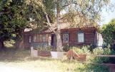
Bolshaya Izhora House of Culture
Bolshaya Izhora Settlement Library, the
Finns of Ingermanlandia
Izhora (Izhora men)


Mentioned in articles:

Lomonosov District
LOMONOSOV DISTRICT. Area: 1990.8 sq. km. Population: 65,300. Established in 1927. L. D. comprises Bolshaya Izhora and Lebyazhye urban settlements and 140 rural localities. It borders St. Petersburg and Kingisepp, Volosovo, and Gatchina Districts of... more