Okhta River, the
Group name
Topographical landmarks
Mentioned in articles:
|
hidden
|
Murino, settlement
MURINO, a settlement in Vsevolozhsk District. Population: 5000. Located near the border of St. Petersburg on the bank of the Okhta River, at Devyatkino railway station and Devyatkino underground station. The village has been known since the early... more
|
|
|
|
hidden
|
Neva River, the
NEVA, river in Leningrad Oblast and SPb. It was formed c. 3000 years ago due to a water breakthrough from Lake Ladoga to the Baltic Sea along the old valleys of the Mga and Tosna rivers. The toponym “Neva” is borrowed from the Baltic Finnish... more
|
|
|
|
hidden
|
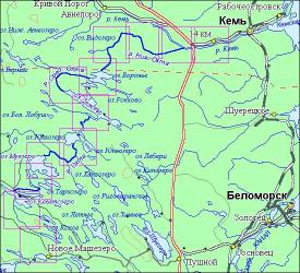
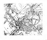
Okhta River, the
OKHTA (Finnish “bear river”), a river in the Karelian Isthmus, largest right-hand tributary of the Neva. Length: 90 km, width: – 30-40 m, predominating depth: 0.5-1 m, max. depth: 5.5 m. Basin area: 768 sq. km. Average flow rate at the mouth: 7.2... more
|
|
|
|
hidden
|
Roads
ROADS. Historically, the road network in the territory of Leningrad oblast has been developing unevenly: the regions east of the Volkhov River are worse provided with R. because the principal economic, military, and cultural centers have always been... more
|
|
|
|
hidden
|
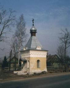
Vartemyaki, a country estate
Vartemyaki, a country estate (the village of Vartemyaki, the Vsevolozhsk district). A grange on the River Okhta bank was granted by Catherine I to Major-General I.M. Shuvalov, the governor Vyborg, in 1726. The estate was stared to build under his... more
|
|
|
|
hidden
|
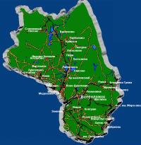
Vsevolozhsk District
VSEVOLOZHSK DISTRICT, a part of Leningrad Oblast. Area: 2945.4 sq. km. Population: 215,200. Adm. center: Vsevolozhsk Town. Comprises Sertolovo Town, six urban settlements (Dubrovka, settlement named after Morozov, settlement named after Sverdlov,... more
|
|
|
|