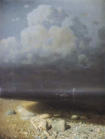
ru
Articles / Ladoga Lake
2/4

Ladoga Lake


Subject / Topography/Reservoirs and waterways

LAKE LADOGA. Located in Leningrad Oblast and the Republic of Karelia. In the Middle Ages, it was called Nevo (Baltic Finnish nevo = “moss marsh.”) The current name originates from the middle Scand. Aldoga (fm the Baltic Finnish Alodejogi = “the Lower River”, as the Ladozhka River was called, or fm the Finnish aalto = “wave.”) Area: 18,100 sq. km (incl. island area of 456.6 sq. km.) The largest in Europe (the world’s 16th.). Max. length: 219 km, max. width: 125 km. Max. depth: 225 m (north of Valaam), average depth: abt. 50 m. The basin of L. L. (catchment area: 258,000 sq. km) consists of four secondary basins: L. L. own basin (28,400 sq. km), Onega-Svir (83,200 sq. km), Ilmen-Volkhov (80,200 sq. km), Saimaa-Vuoksa (66,700 sq. km). The largest rivers flowing into L. O. are the Volkhov, Svir, and Vuoksa. The Neva is the only river flowing out of the lake, to connect it to the Gulf of Finland, Baltic Sea. L. L. has abt. 660 islands (of these, over 500 islands are near the north-western shore.) The largest of them are Riekkalansari (55.3 sq. km), Mantinsari (39,4 sq. km), Kilpola (32.1 sq. km), Tulonsari (30.3 sq. km), Valaam (27.8 sq. km.) The lake’s northern shores are tall, rocky, indented with skerries; the southern shores are low and waterlogged. L. L. is populated by abt. 60 species of fish; of commercial value are salmon, lake char, whitefish (Ludoga whitefish is most known), vendace, smelt, cisco, pike perch, bream, perch. In the early Middle Ages, the “Trade road from the Varangians to the Greeks” extended via L.L. Shipping was obstructed by frequent storms and numerous sandy and stone bars and shallows, and aggregations of boulders on the bed in the southern part. To ensure navigation, the Ladoga Canals were built along the southern shore in the 18th – 19th centuries. Free shipping in L. L. only became possible in the 2nd half of the 20th century after the “sea-river” class ships appeared. On the L.L. shore (within Leningrad Oblast) are the cities of Priozersk, Schlusselburg, Novaya Ladoga; in Karelia, the cities of Lahdenpohja, Sortavala, Olonets. The scientific study began in the 18th century (see N. Y. Ozeretskovsky.) In 1858-67 and 1873, the expedition of A. P. Andreev arranged by the Hydrographic Dept. of the Ministry of the Navy operated on L. L. In 1897-99 and 1901-03, Y. M. Shokalsky studied L. L. In 1951-56, the lake was surveyed by the Baltic hydrographic expedition. Since 1956, the monitoring has been provided by the Limnology Institute of the Acad. of Sc., and since1992, also by the Institute of Water Problems of the North, Acad. of Sc. (Petrozavodsk.) In the 1980s, actions were started to improve the environment of L. L. In 1984, the USSR Government Resolution “On additional measures to ensure protection and conservation of water and other natural resources of the basin of Lakes Ladoga, Onega, and Ilmen” was adopted. Since the 1990s, due to a business recession during the economic crisis, the environmental situation has improved: in 1997, the effluent discharge within the L. L. catchment area was 411 million cu. m, that is by 24% less than in 1992. The Ladoga skerries in the northern part of L. L. are a popular touring site. Sightseeing and pilgrimage tours to the islands of Valaam and Konevets are provided.

Authors
Chistyakov, Anton Yuryevich

Persons
Andreyev, Aleksandr Petrovich
Ozeretskovsky, Nikolay Yakovlevich
Shokalsky, Yuly Mikhailovich

Geography
Topographical landmarks/Gulf of Finland, the
Topographical landmarks/Ilmen Lake
Neighbouring Territories/Karelian Republic
Topographical landmarks/Kilpola Island
Topographical landmarks/Konevets, Island
Topographical landmarks/Ladoga Canals, the
Topographical landmarks/Ladozhka River, the
Topographical landmarks/Mantinsari Island
Topographical landmarks/Neva River, the
Leningrad Oblast, the/Volkhov District/Novaya Ladoga Town
Topographical landmarks/Onega Lake
Neighbouring Territories/Petrozavodsk City
Leningrad Oblast, the/Priozersk District/Priozersk Town
Topographical landmarks/Riyekkalansari Island
Leningrad Oblast, the/Shlisselburg Town
Topographical landmarks/Svir River, the
Topographical landmarks/Tulonsari Island
Topographical landmarks/Valaam Island
Topographical landmarks/Volkhov River, the
Topographical landmarks/Vuoksa River, the

Bibliography
Калесник С. В. Ладожское озеро. Л., 1968
Горелова Э. М., Кириллова В. А., Распопов И. М. Ладога. Л., 1974
Ладожское озеро. Мониторинг, исследование современного состояния и проблемы управлением Ладожским озером и другими большими озерами. Петрозаводск, 2000
Ладожское озеро: прошлое, настоящее, будущее. СПб., 2002.
сайт «Ладожское озеро». URL: http://www.laatokka.info

Subject Index
Trade route from the Varangians to the Greeks