|
hidden
|
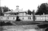
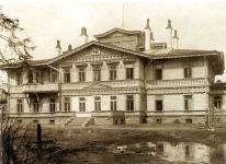
Batovo, a country estate
Batovo, an estate (the village of Batovo, the Gatchina district). Located on the bank of the River Oredezh village of Batovo was granted by Paul I to Major-General P.F. Malyutin, an ex-officer of the Gatchina units. In 1800 Malyutin presented the... more
|
|
|
|
hidden
|
Belogorka, a country estate
Belogorka, a country estate (the village of Belogorka, the Gatchina district). The estate ("Belya Gorka") was named after its first owner F.F. Bell, a marshal of the nobility of the Tsarskoye Selo uyezd, which bought the village of Novaya Siverskaya... more
|
|
|
|
hidden
|
Bolshoye Zarechye, village (Volosovo District)
BOLSHOYE ZARECHYE, before 1943 a village in Volosovo District. It was located on the right bank of the Oredezh River on the Vyra-Kikerino Highway. It was mentioned in the 1499/1500 scribe roll as the center of a Novgorod pogost. Population: Russians... more
|
|
|
|
hidden
|
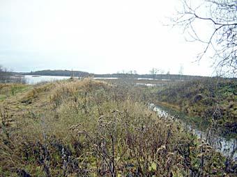
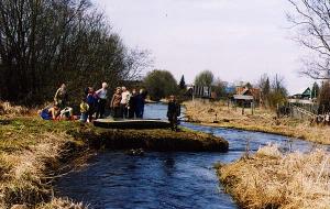
"Dontso", an terrain area
"Dontso", an terrain feature. It is located in the Volosov District in the territory of the region complex natural monument “Istoki reki Oredeg v urochihe Dontso” (The source of the River Oredezh in the terrain feature of Dontso). This natural... more
|
|
|
|
hidden
|
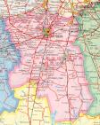
Gatchina District
GATCHINA DISTRICT, municipal entity. Population: 111,600. Area: 2850.3 sq. km. Established in 1927. Due to renaming of Gatchina Town, it was called Trotsk District in 1927-29, and Krasnogvardeisk District in 1929-44.Gatchina district borders with... more
|
|
|
|
hidden
|
Izhora (Izhora men)
Izhora (Izhoras, the own native name is Izurit) is an ethnic community. Their language is related to the Baltic-Finnic subgroup of the Finno-Ugric branch of the Uralic language family. Accorging to the most widespread version the Izhora separated... more
|
|
|
|
hidden
|
Luga District
LUGA DISTRICT, municipal entity. Population: 44,600. Area: 5993.1 sq. km. Located in the south of Leningrad Oblast. In the west, it borders Slantsy District, in the north, Volosovo, Gatchina, and Tosno Districts of Leningrad Oblast; in the east,... more
|
|
|
|
hidden
|
Luga River, the
LUGA, river. It flows in Novgorod Oblast and in Luga, Volosovo, and Kingisepp Districts of Leningrad Oblast. Length: 353 km (the longest river in Leningrad Oblast.) Catchment area: 13,200 sq. km. Flow rate: 100 cu. m / s. Its width is 50-100 m in... more
|
|
|
|
hidden
|
Natural monuments
The natural monument is the category of the specially protected natural areas and in the international classification they have status of the natural monument. They are a small area, which include important natural objects (terrain feature, groves... more
|
|
|
|
hidden
|
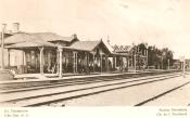
Oredezh, settlement
OREDEZH, a settlement in Luga District. Population: 2682. Located on the left bank of the Oredezh River, which gave the name to the settlement. It is connected with a motor road to Luga Town and localities of the eastern part of the district;... more
|
|
|
|
hidden
|
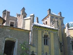
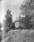
Rozhdestvenno, village
ROZHDESTVENO, a village in Gatchina District. Population: 1900. Located on the Kiev Highway route at the interfluve of the Oredezh and Gryaznaya Rivers. Medieval burial mounds have been discovered in the environs of R. It is mentioned in Novgorod’s... more
|
|
|
|
hidden
|
Siversky, urban settlement
SIVERSKY, an urban settlement in Gatchina District. Population: 12,100. It is situated on the right bank of the Oredezh River. The name originates from Seversko Staroye and Seversko Novoye villages mentioned in Novgorod’s 1499 scribe roll.... more
|
|
|
|
hidden
|
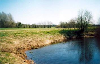
Suyda River, the
SUYDA (Suydinka), a river in Gatchina District. Length: 63 km. Catchment area: 475 sq. km. Flow rate: 3.1 cu. m/s. Its source is in a marsh north-west of Tikhkovitsi village. It is a karst river. It flows among fields and meadows, with its banks... more
|
|
|
|
hidden
|
The Skete of St. Seraphim
The Skete of St. Seraphim of the St Alexander Nevsky Lavra, it was placed in the Luga Uyezd, at 13 kilometre from the station of Preobrazhenskaya (now it is the settlement of Tolmachevo). In 1901 the Lavra bought the Zacherenye country estate ... more
|
|
|
hidden
|
Toponymia of the Leningrad Oblast, the
The leningrad Oblast toponymia. Toponymia is the combination of toponyms, proper names of geographical objects. There are several kinds of toponyms: hydronym, a name of water object; oikonym, a name of a settlement; horonym, an element of relief;... more
|
|
|
hidden
|
Toponymy legends
Toponymia legends. A toponymia legend is an oral story passed on from generation to generation by the population group and including the information about appearing names of geographic objects (toponyms). The toponymia studies toponyms, ... more
|
|
|
hidden
|
"Verkhny Oredezh", a natural historical park
Verkhny Oredezh (“The Upper Oredezh”) is a natural historical park the concept of foundation which is considered by the Government of the Leningrad Oblast. The initiator of the project is A.A. Semochkin, the director of the memorial country estate... more
|
|
|
|
hidden
|
Volosovo District
VOLOSOVO DISTRICT, a part of Leningrad Oblast. Area: 2680.5 sq. km. Population: 46,900. Adm. center: Volosovo Town. The district comprises Kikerino urban settlement, and 202 rural localities. It borders Kingisepp, Lomonosov, Gatchina, and Luga... more
|
|
|
|
hidden
|
Vyra, a country estate
Vyra, a country estate (the village of Vyra, the Gatchina district). The estate belonged to Major-General P.F. Malyutin which bought it to M.F. Donaurova, the widow of a chamberlain, in 1817. She built a country estate on the bank of the River... more
|
|
|
|
hidden
|
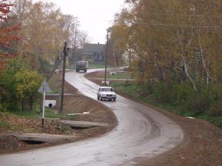
Vyra, village
VYRA, a village in Gatchina District. Population: 257. It is located on the banks of the Oredezh River. The Kiev Highway extends across V. The toponym Vyra is traced to “vyr” or “vir” (Slav) = abyss or deep (a Baltic Finnish origin of the name is... more
|
|
|
|
hidden
|
Vyritsa, urban settlement
VYRITSA, an urban settlement in Gatchina District. Population: 13,700. It is situated on the Oredezh River. The name evidently originates from the Russian word “vyr’” meaning “deep” or “whirlpool.” The largest dacha settlement in terms of area... more
|
|
|
|
hidden
|
|
hidden
|