|
hidden
|
Children Art Schools
CHILDREN’S ARTS SCHOOLS (CAS). In the last years Children’s Musical Schools (CMS) and Children’s Painting Schools (CPS) have had a growing tendency for unification into Children’s Arts Schools (CAS). By 2007 the Leningrad oblast had had 104 CAS,... more
|
|
|
|
hidden
|
Co-operative gardens
CO-OPERATIVE GARDENS, noncommercial organizations established in the form of noncommercial partnerships or consumers’ cooperatives (their activity is regulated by the federal laws “On Noncommercial Organizations” of Jan. 12, 1996 and “On Gardening,... more
|
|
|
|
hidden
|
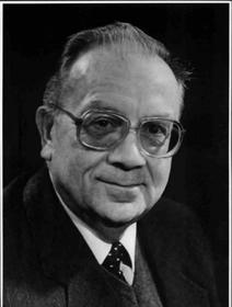
Gadlo, Aleksandr Vilyamovich (1937-2002), a scholar
Aleksandr Vilyamovich Gadlo (1937-2002) was an ethnograph, archaeologist. In 1985 he became a Doctor of History. He graduated from the historical faculty of the Leningrad State University (1961) and was a student of the academician M.I.Artamonov. He... more
|
|
|
|
hidden
|
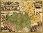
Ingermanlandia
INGERMANLANDIA (Swed. Ingermanland, Rus. Izhora Land or Ingria), historic and cultural region in the western part of the Leningrad Oblast (Kingisepp, Volosovo, Lomonosov, Vsevolozhsk, Gatchina, Tosno, western part of Kirovsk Districts.) The western... more
|
|
|
|
hidden
|
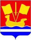
Kirovsk District coat of arms and flag, the
The Kirovsk District's coat of arms and flag were official approved with the decisions of the Municipal Assembly of the Municipal Union “Kirovskiy rayon” (The Kirovsk District) of 15 April 1998, No. 224 and 20 January 1999. The heraldic description... more
|
|
|
|
hidden
|
Kobona, village
KOBONA, a village in Kirovsk District. Population: 133. Located near the Ladoga Canals on the coast of Lake Ladoga, at the mouth of the Kobonka River. The toponym originates from the Finnish “hapana” = rotten. It is mentioned in Novgorod’s scribe... more
|
|
|
|
hidden
|
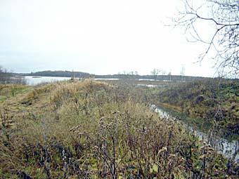
Lava River, the
LAVA, a river in Kirovsk District. Length: 51 km. It flows out of the marshes that are situated to the east of the urban settlement of Nazia, and it flows into Lake Ladoga (Petrokrepost Bay.) The toponym is of a Baltic Finnish origin (Finnish.... more
|
|
|
|
hidden
|
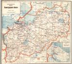
Leningrad Oblast, the
LENINGRAD OBLAST, subject territory of RF. Area: 83,900 sq. Km (max. Extension from west to east: 446 km, north to south: 325 km.) Population (as of 2002): 1,669,000. The Oblast borders Pskov and Novgorod Oblasts in the south, Vologda Oblast in the... more
|
|
|
|
hidden
|
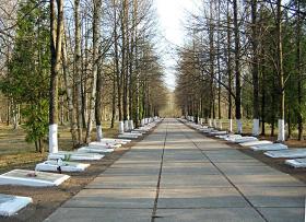
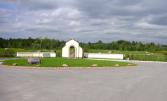
Memorials to the Great Patriotic War
Memorials to the Great Patriotic War. The idea of creating memorials on the firing lines of the Leningrad defence appeared in the years of World War II. The first temporary monuments on the line of the Leningrad front were builtin 1944-45 after the... more
|
|
|
|
hidden
|
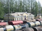
Mga, urban settlement
MGA, an urban settlement in Kirovsk District. Population: 9,600. The name originates from the Mga River on whose left bank the settlement is situated. M. has a favorable transport position as a large railway junction, having also access to... more
|
|
|
|
hidden
|
Municipal Unions
MUNICIPAL ENTITIES, urban or rural (may comprise several united rural localities, such as a volost in Leningrad Oblast) – a settlement, municipal district, or urban area (and an intra-city area of a federal level city), where local government is... more
|
|
|
hidden
|
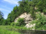
Natural monuments
The natural monument is the category of the specially protected natural areas and in the international classification they have status of the natural monument. They are a small area, which include important natural objects (terrain feature, groves... more
|
|
|
|
hidden
|
Naziya, urban settlement
NAZIYA, an urban settlement in Kirovsk District. Population: 5,800. It is situated in the central part of Leningrad Oblast on the banks of the Lava and Kovra rivers. It is connected with a motor road to the St. Petersburg-Novaya Ladoga highway.... more
|
|
|
hidden
|
Pavlovo, urban settlement
PAVLOVO, an urban settlement in Kirovsk District. Population: 3,400. It is situated at the influx of the Mga River into the Neva. It is connected with motor roads to the district’s towns and rural localities. P. comprises Pavlovo-on-Neva railway... more
|
|
|
hidden
|
Priladozhsky, urban settlement
PRILADOZHSKY, an urban settlement in Kirovsk District. Population: 5,200. The settlement’s name is related to its situation south of the Lake Ladoga coast. P. is in the center of the district, close to the Murmansk Highway, 27 km away from... more
|
|
|
|
hidden
|
Putilovo, village
PUTILOVO, a village in Kirovsk District. Population: 1,500. Located at the edge of the Putilovo Hills, whose name originates from the Slav name Putilo. The Murmansk Highway extends close to the village. In the 17th c. it was the center of the... more
|
|
|
|
hidden
|
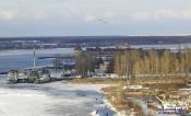
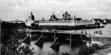
Schlusselburg, town
SCHLÜSSELBURG (Petrokrepost in 1944-92), a town in Kirovsk District. In 1996–2005, a separate municipal entity. Population: 12,400. Located at the head of the Neva River, on its left bank. S. is connected by bus service to Kirovsk and St.... more
|
|
|
|
hidden
|
Sinyavino, urban settlement
SINYAVINO, an urban settlement in Kirovsk District. Population: 3,600. Administratively subordinate to S. is Sinyavino-– settlement located 10 km east of the basic settlement. The name is related to the family name of the Russian admirals Sinyavin... more
|
|
|
|
hidden
|
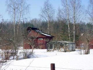
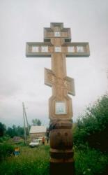
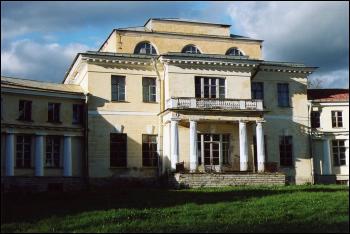
Sologubovka, settlement
SOLOGUBOVKA, a village in Kirovsk District. Population: 361. Located on the right bank of the Mga River. North-east of S. is the railway station of the same name of the Mga-Kirishi line (opened in 1919). In the 19th c. it was the Uspenskaya estate.... more
|
|
|
|
hidden
|
Tikhvin Canal System
TIKHVIN CANAL SYSTEM, a traffic artery in the north-west of European Russia. It connected the basins of the Baltic Sea and the Volga in the 19th-20th cc. It began at the city of Rybinsk on the Volga (later at the Rybinsk Reservoir), extended via the... more
|
|
|
|
hidden
|
Toponymy legends
Toponymia legends. A toponymia legend is an oral story passed on from generation to generation by the population group and including the information about appearing names of geographic objects (toponyms). The toponymia studies toponyms, ... more
|
|
|
hidden
|
Tosna River, the
TOSNA, river, left-hand tributary of the Neva. It flows in Luga, Tosno, and Kirovsk Districts of Leningrad Oblast and in St. Petersburg. Length: 121 km. Catchment area: 1640 sq. km. Flow rate: 11.6 cu. m/s. The source is in Luga District, 5 km... more
|
|
|
|
hidden
|
Tosno District
TOSNO DISTRICT, municipal entity. Located in the south of the central part of Leningrad Oblast, bordering Gatchina District in the west, St. Petersburg in the north-west, Kirovsk District in the north-north-west, Kirishi District in the east,... more
|
|
|
|
hidden
|