|
hidden
|
Archaeological monuments
Archaeological monuments of the Leningrad Oblast are settlements, grads, burial grounds, religious objects and other material trails of the past. Settling the oblast territory took place during the Mesolithic period. The age of the most ancient... more
|
|
|
|
hidden
|
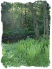
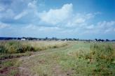
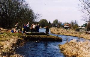
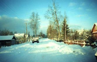
Drainage network
HYDROGRAPHIC NETWORK. Over 19500 rivers and 1800 lakes (Ladoga and Onega being the largest ones) form the H. N. of the Leningrad Oblast. The river network is dense and ramified. One exception is the Izhora Hills where the river network density is... more
|
|
|
|
hidden
|
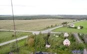
Dyatlitsi, village
DYATLITSI, a village in Lomonosov District. Population: 133. It is located in the northern part of the Izhora Hills, east of the Voiskovitsi-Bolshaya Izhora highway. First mention was in Novgorod’s scribe roll of 1499/1500 as the center of... more
|
|
|
|
hidden
|
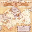
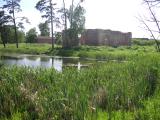
Gatchina District
GATCHINA DISTRICT, municipal entity. Population: 111,600. Area: 2850.3 sq. km. Established in 1927. Due to renaming of Gatchina Town, it was called Trotsk District in 1927-29, and Krasnogvardeisk District in 1929-44.Gatchina district borders with... more
|
|
|
|
hidden
|
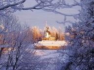
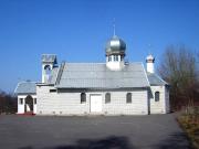
Gostilitsi, village
GOSTILITSI, a village in Lomonosov District. Population: 3600. It is located at the northern edge of the Izhora Hills, on the Gostilka River. The name originates from the Novgorod name Gostilo. First mention was in Novgorod’s scribe roll of... more
|
|
|
|
hidden
|
Ivanovsky, Lev Konstantinovich (1845-1892), a scientist
Ivanovsky, Lev Konstantinovich (1845-1892), a doctor, archaeologist, anthropologist. He graduated the Medical and Surgical Academy in 1869 with the gold medal and he was suggested to work as an assistant lecturer at the descriptive anatomy... more
|
|
|
hidden
|
Kaybolovo, village
KAYBOLOVO, a village in Kingisepp District. Population: 75. It is located on the Suma River (north-western part of the Izhora Hills). 2 km west of K., the Kaybolovskoye ancient site was discovered. It is an earthwork dated 2nd half of the 12th to... more
|
|
|
|
hidden
|
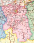
Kingisepp District
KINGISEPP DISTRICT, a part of Leningrad Oblast. Population: 74,300, of which, 52,100 live in the adm. center Kingisepp Town. Area: 2842.1 sq. km. It has 191 rural settlements. It was established in 1927.It borders with Lomonosov, Volosovo, and... more
|
|
|
|
hidden
|
Kipen, village
KIPEN, a village in Lomonosov District. Population: 3100. It is located in the northern part of the Izhora Hills. It is situated at the crossing of roads to Strelna, Volosovo, Gatchina, with the Tallinn Highway close by. The toponym originates from... more
|
|
|
|
hidden
|
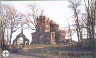
Klopitsi, village
KLOPITSI, a village in Volosovo District. Population: 1100. Located on the Izhora Hills, at the motor road from Kikerino to the Tallinn Highway. In the 18th c., K. had a wooden church of Annunciation of the Blessed Virgin (according to other... more
|
|
|
|
hidden
|
Kotli, village
KOTLI (Finnish Kattila), a village in Kingisepp District. Population: 2013, mostly Russians and Vod. Located at the north-western end of the Izhora Hills, on a glint terrace. First mentioned in the 1499/1500 Rent Census Book of Vodskaya Pyatina as... more
|
|
|
|
hidden
|
Lomonosov District
LOMONOSOV DISTRICT. Area: 1990.8 sq. km. Population: 65,300. Established in 1927. L. D. comprises Bolshaya Izhora and Lebyazhye urban settlements and 140 rural localities. It borders St. Petersburg and Kingisepp, Volosovo, and Gatchina Districts of... more
|
|
|
|
hidden
|
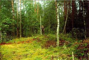
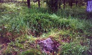
Old Russian Kurgans (barrows)
The Old Russian kurgans (barrows) are mounds over graves of the 10th-14th centuries. In old Russian towns barrow burials were stopped in the 11th century after adopting Christianity. The rural population continued to bury according to the Pagan... more
|
|
|
|
hidden
|
Opolye, village
OPOLYE, a village in Kingisepp District. Population: 1066. The toponym originates from “opolye” = field edge, or elevated woodless plain. It is locate at the crossing of the Tallinn Highway and the Opolye-Volosovo-Gatchina road in the west of the... more
|
|
|
|
hidden
|
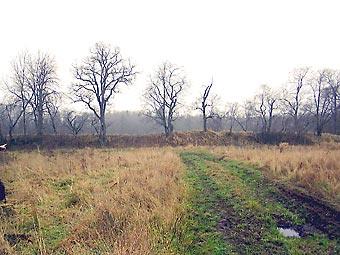
Oredezh River, the
OREDEZH, river, right-hand tributary of the Luga River. Length: 192 km. Catchment area: 3,200 sq. km. Flow rate: 20 cu. m/s. It originates from the springs on the southern slope of the Izhora Hills, in the Dontso tract. It flows across Volosovo,... more
|
|
|
|
hidden
|
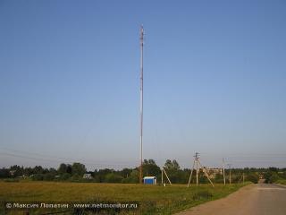
Roads
ROADS. Historically, the road network in the territory of Leningrad oblast has been developing unevenly: the regions east of the Volkhov River are worse provided with R. because the principal economic, military, and cultural centers have always been... more
|
|
|
|
hidden
|
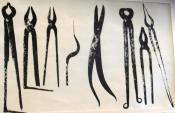
Treasures
Treasures are deliberately hidden riches mostly buried by the owner. About fourty coin, coin and thing, and thing treasures were found in the Leningraf Oblast territory under different circumstances. The unique treasure of craftman tools and... more
|
|
|
|
hidden
|
Volosovo District
VOLOSOVO DISTRICT, a part of Leningrad Oblast. Area: 2680.5 sq. km. Population: 46,900. Adm. center: Volosovo Town. The district comprises Kikerino urban settlement, and 202 rural localities. It borders Kingisepp, Lomonosov, Gatchina, and Luga... more
|
|
|
|
hidden
|
Volosovo, town
VOLOSOVO, a town in Volosovo District and its adm. center. Population: 11,700. It is located on the Izhora Hills, at a station of the same name of the Gatchina–Ivangorod railway branch. The toponym V. is related to the name of the Slav pagan god... more
|
|
|
|
hidden
|
Zhalniks (sepulcrums).
Zhalniks (sepulcrums), burial places of the rural population of the Novgorod land of the 12th -15th centuries. On the Leningrad Oblast territory there are known zones of the Old Russian farming colonization: the Luga-Oredezh region, the Izhora... more
|
|
|