|
hidden
|
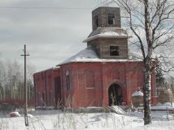
Tolmachevo, urban settlement
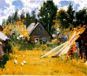
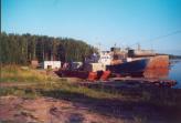
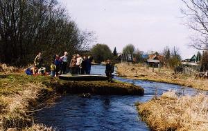
TOLMACHEVO, an urban settlement in Luga District. Population: 3,400. It is situated on the banks of the Luga River. The St. Petersburg-Pskov railway and Kiev Highway extend close by. Up to the early 1990s, there was steamboat service from the... more
|
|
|
|
hidden
|
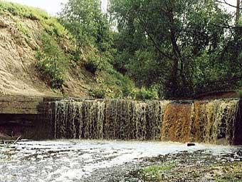
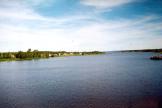
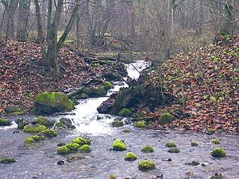
Tosna River, the
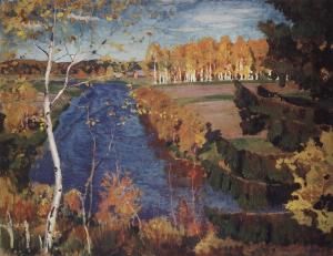
TOSNA, river, left-hand tributary of the Neva. It flows in Luga, Tosno, and Kirovsk Districts of Leningrad Oblast and in St. Petersburg. Length: 121 km. Catchment area: 1640 sq. km. Flow rate: 11.6 cu. m/s. The source is in Luga District, 5 km... more
|
|
|
|
hidden
|
Tosno District
TOSNO DISTRICT, municipal entity. Located in the south of the central part of Leningrad Oblast, bordering Gatchina District in the west, St. Petersburg in the north-west, Kirovsk District in the north-north-west, Kirishi District in the east,... more
|
|
|
|
hidden
|
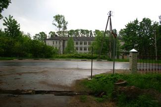
Tosno, town
TOSNO, town, adm. center of Tosno District. Population: 38,700.It is situated on the banks of the Tosna River (most of the town is on the river’s left bank.) Its was named by the river’s name having an Baltic or Slav origin. The town is at the... more
|
|
|
|
hidden
|
Trotsk*, v. Gatchina, town
reference
|
|
|
hidden
|
Tsvelodubovo, settlement
TSVELODUBOVO (Finnish Kaukolempiälä before 1948), a settlement in Vyborg District. Population: 1,200. Located near Lake Nakhimovskoye (previously Suulajarvi.) Initially, the settlement was one of the three parts of a large village of Voipiälä that... more
|
|
|
|
hidden
|
Ulyanovka, urban settlement
ULYANOVKA (Sablino before 1922), an urban settlement in Tosno District. Population: 9200. It is situated on the Tosna and Sablinka rivers. The Moscow Highway extends close by. In the 1720s, there was Sablin’s tavern at that place, which gave the... more
|
|
|
|
hidden
|
Union of Communes of the Northen Oblast
UNION OF COMMUNES OF THE NORTHERN OBLAST (UCNO), an oblast association of Soviets in 1918-19. It included Petrograd, Novgorod, Pskov, Olonets, Archangel, Vologda, North Dvina (separated from Archangel Gubernia in June 1918), and Cherepovets... more
|
|
|
|
hidden
|
Urban settlement named after Morozov
NAMED AFTER MOROZOV, an urban settlement in Vsevolozhsk District. Population: 10,700. Located on the right bank of the Neva near its source, opposite to the Oreshek Fortress. The St. Petersburg-Nevskaya Dubrovka railway branch extends near this... more
|
|
|
|
hidden
|
Urban settlement named after Sverdlov
NAMED AFTER SVERDLOV, an urban settlement in Vsevolozhsk District. Population: 9,200. It situated on the Neva’s right bank, downstream of the Ivanovsky Rapids. Named after Y. M. Sverdlov, a Bolshevik revolutionary. It was given the status of a... more
|
|
|
|
hidden
|
Ushaki, settlement
USHAKI, a settlement in Tosno District. Population: 1823. The settlement appeared at Ushaki railway station after the St. Petersburg-Moscow branch was opened in 1851. The St. Petersburg-Moscow highway also extends across U. The toponym originates... more
|
|
|
|
hidden
|
Ust-Luga, settlement
UST-LUGA, a settlement in Kingisepp District. Population: 1990; apart from the Russians, Izhora and Vod families live in U.-L. and its environs. Located in the mouth of the Luga River. Adjacent to U.-L. is Krakolye village. The settlement appeared... more
|
|
|
|
hidden
|
Uuras*, v. Vysotsk, town
reference
|
|
|
hidden
|
Uusikirkko*, v. Polyani, settlement
reference
|
|
|
hidden
|
Uyezds
UYEZDS, adm. and territorial units in Rus from the 13th century uniting several volosts and governed by Governors General. In the 15th – 16th centuries, in the course of rise of the united Russian State, they became the core link of the... more
|
|
|
hidden
|
v. Sankt-Peterburg Gubernia, the
ST. PETERSBURG GUBERNIA, historic adm. and territorial unit of Russia. Established in 1708 by the decree of Peter I subdividing Russia into eight gubernias. It included the areas of the current Leningrad, Novgorod, Pskov, and Tver Oblasts, and... more
|
|
|
|
hidden
|
Valkyarvi*, v. Michurinskoye, settlement
reference
|
|
|
hidden
|
Vartemyagi, village
VARTEMYAGI (Vartemäki), a village in Vsevolozhsk District. Population: 1100. The toponym originates from the Finnish Vartiomaki = Watchtower Hill and is probably related to the sentry post at the Russian-Swedish border established by the 1323 Treaty... more
|
|
|
|
hidden
|
Vazhini, urban settlement
VAZHINI, an urban settlement in Podporozhye District. Population: 3,300. It is situated at the confluence of the Vazhinka and Svir rivers, north-east of Svir railway station on the Volkhovstroy-Murmansk line. The name originates from the Vazhinka... more
|
|
|
|
hidden
|
Velkota, village
VELKOTA, a village in Kingisepp District. Population: 47. In the environs of V., on a part of an Ordovician limestone table land, there is the “Velkota Village Groves” State integrated natural reserve (area: 375 hectares) preserving oak, elm, and... more
|
|
|
|
hidden
|
Venyaya Valkyarvi*, v. Sapyornoye, settlement
reference
|
|
|
hidden
|
Verkhniye Mandrogi, village
VERKHNIYE MANDROGI, a village in Podporozhye District. Population: 403. The name’s origin is related to the Karelian words “mandere” = mainland, land, coast, or forest on a bedrock shore, and “jogi” = river. It is located on the right bank of the... more
|
|
|
|
hidden
|
Vinnitsi, village
VINNITSI, a village in Podporozhye District. Population: 2158. It is located in the upper reach of the Oyat River. Veps name: Vingl. It is supposed that the Russian name of the village is related to the Veps word “venianik” = Russian. Current... more
|
|
|
|
hidden
|
Vistino, village
VISTINO, a village in Kingisepp District. Population: 909.It is known from the 17th century. It is located on the western coast of the Soikino Peninsula, the area of the most compact population of the Izhora, whose history and culture is related to... more
|
|
|
|
hidden
|
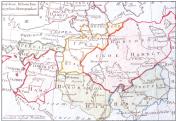
Vodskaya Land
VODSKAYA LAND (Votskaya Land), historic, cultural, and administrative region of the middle-age Rus, located in the north-western part of Veliky Novgorod’s lands (western part of the current Leningrad Oblast.) First mentioned in the chronicle c.... more
|
|
|
hidden
|
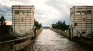
Volgo-Baltic Waterway, the
The VOLGO-BALTIC WATERWAY, artificial waterway in the North-West of Russia connecting the Neva River basin with the basins of rivers of the Volga and the Northern Dvina. Its history is traceable back to the Mariyinsky Canal System, the... more
|
|
|
|
hidden
|
Volkhov District
VOLKHOV DISTRICT, a part of Leningrad Oblast. Area: 5124 sq. km, population: 97,300. Established in 1927. Adm. center: Volkhov Town. V. D. comprises the towns of Syasstroy and Novaya Ladoga, and 277 rural localities. Located south of Lake Ladoga on... more
|
|
|
|
hidden
|
Volkhov River, the
VOLKHOV, river. It flows out of Lake Ilmen in Novgorod Oblast, extends across Kirishi and Volkhov Districts of Leningrad Oblast, and it flows into the Volkhov Bay of Lake Ladoga. Length: 224 km, of which 112 km within Leningrad Oblast. The river bed... more
|
|
|
|
hidden
|
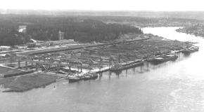
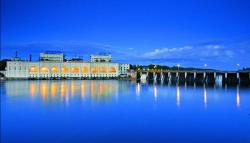
Volkhov, town
VOLKHOV, town. Population: 46,600. Located on both sides of the Volkhov River in its lower course. From the 12th century, there was Mikhailovsky Pogost on the site of V. (the 1500 Novgorod scribe roll mentions Archangel Michael’s Church), which,... more
|
|
|
|
hidden
|
Volosovo District
VOLOSOVO DISTRICT, a part of Leningrad Oblast. Area: 2680.5 sq. km. Population: 46,900. Adm. center: Volosovo Town. The district comprises Kikerino urban settlement, and 202 rural localities. It borders Kingisepp, Lomonosov, Gatchina, and Luga... more
|
|
|